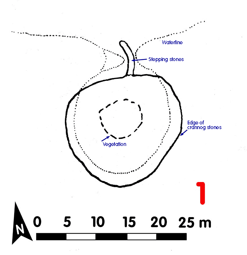
Crannog 1 Loch Awe[click on graphics for larger view in new window] |
Location: Inverliever
Map reference: NM 889 048
Date of Survey: 6 October 1972
Loch level OD: 35.235 m
Highest point of crannog OD: 37.095 m
Usable area: 7 m x 6 m
Description (1972): Small crannog built on a slight natural mound. Small patch of chippings to west and east. Vegetation on top.
A causeway composed of a single line of stepping stones approx 0.75 m at widest, ran for 6 m along a low sand spit to the shore. It would normally be underwater by at least 1 m
Finds:
Dating:
Post-1972:
Interesting find nearby
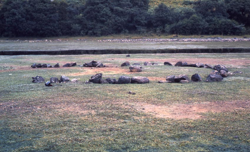
In the next bay up the loch to the north-east ñ Reedy Bay (see photo bottom right) ñ was a setting of single head-sized stones lying on the exposed sand beach. About 6-7 m in diameter, the stones were set in the form of a horseshoe, with a stone in the middle. It would normally be underwater at usual loch levels. No age or function can be suggested, although weights to hold down the net of a fish trap might be a reasonable guess
CLICK TO ENLARGE
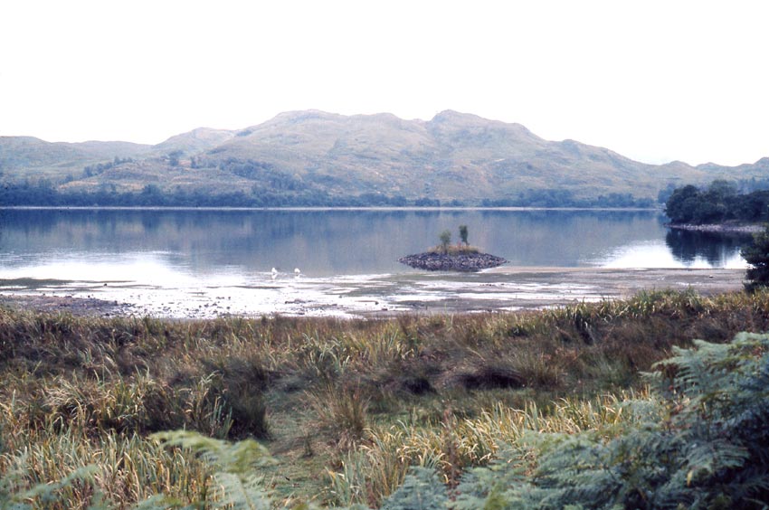
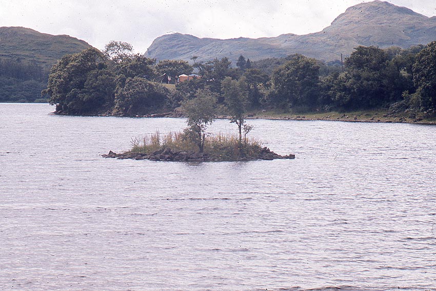
Crannog 1 (above) was almost entirely out of the water in October 1972. At other times, access (below, seen from the N side) is not so simple.
How it is normally. This was the average loch level, which we found in August 1972